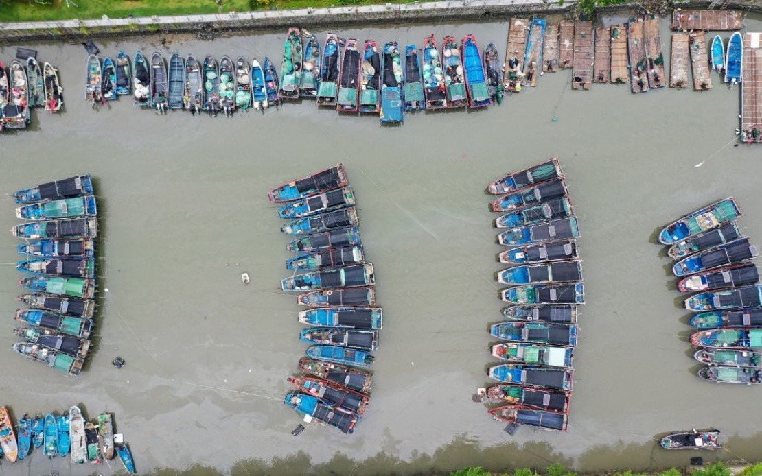
China's meteorological authorities have triggered the maximum alert level in the nation's typhoon warning system as Tropical Cyclone Noul bears down on the populated coast of Guangdong Province in the south. The red alert, announced on Saturday by the National Meteorological Centre, represents the most critical tier in a four-level weather warning framework designed to guide emergency preparedness across the country. This escalation underscores the serious threat posed by the intensifying storm system as it enters a critical phase in its approach to heavily populated areas of southern China.
At the time of the alert, Typhoon Noul was positioned approximately 100 kilometres offshore from Huidong County in Huizhou City, with meteorologists recording maximum sustained winds near its centre reaching Force 14 on the international wind scale. The positioning of the cyclone over relatively shallow coastal waters off Guangdong created conditions favourable for continued strengthening as it moved across the sea surface. The tropical system represents the twelfth named typhoon of the current Pacific typhoon season, indicating a pattern of repeated tropical disturbances affecting East and Southeast Asia during the northern summer months.
The National Meteorological Centre's forecast indicated that Noul would maintain a northwestward trajectory at approximately 20 kilometres per hour while simultaneously intensifying further. This combination of approach speed and strengthening posed particular hazards for coastal communities and maritime traffic in the region. Once the typhoon makes landfall, meteorologists anticipated a shift in its path toward a more northwesterly direction, coupled with gradual weakening as the system moved inland and lost access to warm ocean waters that fuel tropical cyclone development.
In response to the approaching threat, China's State Flood Control and Drought Relief Headquarters elevated its operational status to Level III for Guangdong Province, the second-highest tier in the country's emergency response system for flood and typhoon events. This escalation authorised increased resource deployment, enhanced monitoring protocols, and pre-positioned emergency personnel in anticipation of potential inundation and severe weather impacts. Separately, the same authority activated a Level IV response—the lowest emergency tier—for the inland provinces of Jiangxi and Hunan, indicating a regional rather than nationwide crisis posture.
China's colour-coded weather warning system provides a structured approach to communicating meteorological hazards to the public and triggering corresponding government responses. The red alert ranks above orange, yellow, and blue warnings in severity, signalling the most dangerous conditions and necessitating the most comprehensive precautions. This tiered framework enables authorities to calibrate evacuation orders, transport halts, and industrial shutdowns proportionate to the actual threat level, rather than implementing maximum measures for every storm system.
The timing of Typhoon Noul's approach during the peak Pacific typhoon season reflects broader patterns affecting the maritime regions between East Asia and Southeast Asia. During July and August, tropical systems develop with greater frequency across the western Pacific basin, and those that track into the South China Sea or approach the Chinese coast present recurring challenges for disaster management agencies across the region. Malaysia's own meteorological services monitor such systems closely, as remnants of typhoons can occasionally influence weather patterns across the Malaysian peninsula and Borneo, particularly during the southwest monsoon season.
The forecast track toward Guangdong Province placed several major economic centres in the potential impact zone, including bustling port cities and industrial hubs that serve as critical nodes in Southeast Asian and global supply chains. Disruptions to transportation, shipping, and manufacturing activities in this region often have cascading effects throughout the wider region's economy. Port closures, flight cancellations, and logistics delays associated with major typhoons can temporarily constrain trade flows affecting Malaysian importers and exporters reliant on Chinese supply chains or transit routes through southern China.
Governments throughout the region maintain increasing sophistication in typhoon preparedness and early warning systems, reflecting hard-won lessons from devastating cyclones of recent decades. China's meteorological infrastructure represents one of Asia's most advanced, with extensive networks of weather stations, radar systems, and satellite monitoring capabilities enabling detailed forecasting of tropical systems days in advance. This enhanced predictive capacity allows communities to implement protective measures before storm arrival, significantly reducing casualties compared to historical typhoon impacts.
For Malaysian observers and policymakers, developments in China's typhoon season carry significance beyond mere meteorological interest. Economic linkages between Malaysia and China mean that severe weather disruptions affecting Guangdong's ports, manufacturing sectors, and infrastructure can reverberate through Malaysian trading partners and supply chains. Additionally, the management approaches adopted by Chinese authorities in responding to natural disasters provide comparative examples relevant to Malaysian emergency management frameworks, particularly given similar tropical climate exposure and the shared vulnerability to seasonal typhoons and monsoon-related flooding.

