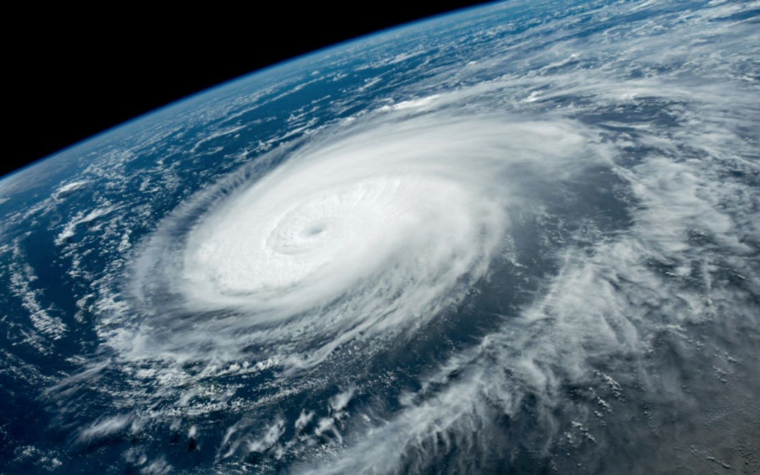
China's meteorological authorities have significantly strengthened their response posture as Typhoon Dolphin moves toward eastern coastal regions, marking a notable escalation in precautionary measures across the country's most densely populated provinces. On Saturday, the National Meteorological Centre upgraded the typhoon's emergency response classification to Level III and raised the public warning from yellow to orange, reflecting growing confidence in the storm's intensity and trajectory as it approaches landfall.
The anticipated impact zone stretches across a critical economic corridor spanning Zhejiang Province to Fujian Province, with the typhoon expected to make landfall between Zhoushan and Fuding sometime between Sunday evening and Monday morning. This timing concentrates the risk during a period when coastal communities typically experience maximum disruption, as residents and authorities have limited daylight hours to complete final preparations before the storm's arrival.
Zhejiang Province, home to major port facilities and manufacturing hubs, has mobilized one of China's most comprehensive disaster-response mechanisms. The provincial government elevated its own typhoon emergency response to the second-highest tier on Saturday, a move that triggered the deployment of more than 4,000 monitoring personnel across over 7,500 identified geological hazard zones. These monitors are tasked with real-time surveillance of areas vulnerable to secondary disasters such as landslides and debris flows, which often prove more destructive than the typhoon's primary winds and rain.
Transportation disruptions in Zhejiang have been severe and sweeping. All 162 passenger ferry routes operating within the province have been suspended, effectively isolating numerous island communities that depend on water-based links to mainland services. Authorities have also ordered the cessation of all work at 193 offshore construction projects and compelled 474 construction vessels to return to port by Friday morning. These measures represent substantial economic losses but are deemed necessary to prevent vessels from being caught in dangerous open water when the typhoon strengthens.
Fujian Province, to the south, has implemented parallel but somewhat less extensive precautions, reflecting either differences in exposure or varying assessments of local vulnerability. The province suspended 40 passenger ferry routes and halted operations at 115 offshore construction sites by Saturday noon. Of particular note, all 1,210 registered fishing boats in the coastal city of Fuding had been recalled to port, indicating thorough coordination between maritime authorities and the fishing industry despite the economic implications of fleet immobilization.
Shanghai, positioned to the north of the immediate impact zone, issued a blue-level typhoon alert on Friday as forecasters warned that Dolphin's circulation could deliver sustained strong winds and heavy precipitation to the city for up to four days. This extended duration reflects the storm's size and forward speed, characteristics that differentiate it from smaller, faster-moving systems. The alert prompted railway operators to announce the suspension of select train services throughout the Yangtze River Delta region beginning Sunday, a measure that will disrupt passenger and freight movements across one of China's primary economic zones.
The severity assessment offered by Xu Yinglong, chief forecaster at the National Meteorological Centre, provides important context for understanding the urgency of current responses. According to Yinglong's analysis, Typhoon Dolphin is projected to generate stronger winds and heavier rainfall than Typhoon Bavi, which made landfall in July. This comparative assessment carries significant weight in justifying the higher alert levels and more aggressive preventive actions, as meteorological forecasters in China generally reserve orange warnings for storms with demonstrable potential for major structural damage and loss of life.
China's hierarchical warning system comprises four colour-coded tiers—red, orange, yellow, and blue—with red representing the most severe threat. The parallel emergency response framework consists of four levels, with Level I denoting the highest national mobilization. That Dolphin has triggered a Level III response, coupled with orange warnings, places the storm in a category reserved for events with significant destructive potential but not necessarily approaching the scale of major historical typhoons.
For Malaysian and Southeast Asian observers, Typhoon Dolphin's trajectory and intensity offer instructive parallels to regional weather systems that periodically affect the peninsula and surrounding waters. The coordinated response across Chinese provinces demonstrates the scale of logistical coordination required when typhoons threaten densely populated coastlines, a scenario that regional governments periodically confront. The deployment of 4,000 monitors to track geological hazards underscores the cascading risks that tropical cyclones pose beyond immediate wind damage, a consideration particularly relevant for Malaysia's mountainous terrain and aging infrastructure.
The suspension of 162 ferry routes in a single province illustrates how completely a major typhoon can paralyze maritime traffic across an entire region, a concern amplified in Southeast Asian waters where ferry services remain critical transport arteries for millions of residents. Malaysian ports and shipping operators facing similar systems must contend with comparable operational shutdowns, making the Chinese experience a useful benchmark for regional emergency planning. The economic cost of preventing 474 construction vessels from working during a weather window represents a conscious trade-off between financial losses and catastrophic risk mitigation that resonates with decision-making frameworks applied throughout Southeast Asia.

