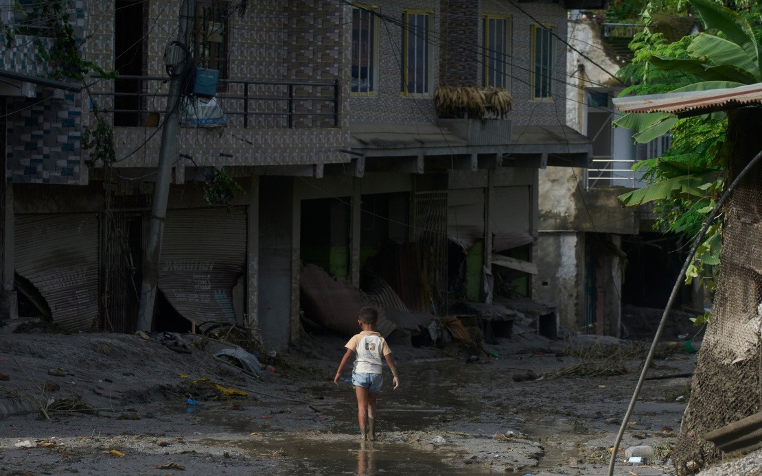
A major mudslide has devastated the Gyirong Port crossing along the China-Nepal border in Xizang Autonomous Region, resulting in at least seven confirmed deaths and leaving 554 people unaccounted for. The disaster, which began on the Nepalese side of the frontier before striking the Chinese border facility in Gyirong County, has triggered one of the region's most significant emergency responses in recent years, with authorities mobilising extensive resources to locate missing persons and prevent further catastrophe.
The incident occurred on Wednesday morning at the strategically important Gyirong Port, one of several key border crossing points between China and Nepal. The facility serves as a critical infrastructure hub for trade and movement between the two countries, handling significant volumes of commercial goods and passenger traffic. The sudden collapse of terrain on the Nepalese side sent massive volumes of mud, rock, and debris cascading across the border, overwhelming the port facilities and catching workers and residents in the immediate vicinity without warning.
Emergency response efforts began immediately following the mudslide, with rescue teams working through the initial chaos to locate survivors. As of early Saturday morning, rescue personnel had managed to extract two local residents from the debris, offering a glimmer of hope amid the widespread devastation. The successful rescues demonstrated that survivors might yet be found amongst the wreckage, though the massive number of missing persons—over seven times the confirmed death toll—suggests that search operations face considerable challenges in the difficult mountainous terrain where the disaster occurred.
The scale of the deployment underscores the severity of the situation and the determination of Chinese authorities to maximise the chances of locating missing individuals. Approximately 2,141 rescue workers have been dispatched to the disaster zone, representing a substantial mobilisation of personnel. Beyond general rescue teams, specialists numbering 86 individuals from natural resources and related technical fields have been sent to assess geological conditions, evaluate structural integrity of surrounding areas, and identify potential for additional collapses. This multi-disciplinary approach reflects recognition that mudslides often trigger cascading hazards that can endanger both survivors and rescue personnel.
Search and stabilisation operations have extended beyond immediate rescue efforts to address secondary risks inherent in the post-disaster environment. Rescue teams equipped with specialised monitoring and detection equipment have undertaken comprehensive geological surveys of slopes and critical infrastructure surrounding the initial impact zone. These inspections aim to identify unstable terrain, weakened structures, and geological formations showing signs of potential failure. Such preventative assessment is crucial in mountainous regions prone to cascading disasters, where one mudslide can trigger additional collapses in destabilised adjacent areas.
A particular concern following major mudslides in such terrain is the formation of barrier lakes—temporary water bodies created when debris dams river valleys. These formations pose serious secondary disaster risks, as they can suddenly breach or overflow without warning, releasing catastrophic floods downstream. To manage this threat, authorities have established a dedicated five-person monitoring station to maintain continuous observation of any barrier lake that may have formed as a consequence of Wednesday's mudslide. This round-the-clock vigilance represents a critical safety measure designed to provide early warning should emergency drainage or evacuation become necessary.
Recovery of basic infrastructure has proceeded in parallel with search operations. Rescue workers have successfully cleared and reopened 1.02 kilometres of road that was blocked or damaged by the mudslide, restoring a crucial supply route to the affected area. This reopening facilitates the flow of additional rescue equipment, personnel rotations, and emergency supplies to the disaster zone, significantly enhancing the logistical capacity of ongoing operations. The restoration of road access also enables evacuation of injured persons to medical facilities and provides escape routes for communities in the immediate vicinity should further geological hazards materialise.
For Malaysian and Southeast Asian observers, the Gyirong Port disaster carries several significant implications. The incident highlights the inherent vulnerabilities of cross-border infrastructure in mountainous regions where geological hazards transcend political boundaries. As Malaysia and neighbouring countries increasingly engage in trade relationships requiring border crossing infrastructure—particularly in hill and mountainous terrain—the Xizang situation demonstrates the necessity of robust geological survey protocols, binational coordination on natural disaster preparedness, and investment in monitoring technologies that can provide early warning of potential collapses or secondary hazards.
The incident also underscores broader questions about infrastructure planning and risk assessment in seismically and geologically active regions. Gyirong Port's location on the China-Nepal border places it within the eastern portions of the Himalayan orogen, a region characterised by complex geological structures and ongoing tectonic activity. Border facilities in such locations must incorporate not merely structural engineering that meets standard building codes, but sophisticated understanding of geological processes that could trigger sudden, catastrophic failures affecting large geographic areas. For similar Southeast Asian contexts—including border regions of Thailand, Laos, and Myanmar with neighbours—the Xizang mudslide provides a cautionary example of necessary precautions.
The Chinese government's rapid and comprehensive response demonstrates its capacity for large-scale disaster management coordination, though challenges remain in the search phase. The deployment of over 2,000 personnel, specialist teams, and monitoring infrastructure within hours of the initial incident reflects institutional capabilities honed through experience with previous natural disasters across the expansive Xizang region. However, the fact that 554 persons remain unaccounted for nearly three days after the event suggests that terrain difficulty, potential burial depth of victims, and the sheer scale of debris movement continue to impede rapid resolution of the missing persons crisis.
As rescue operations continue, the fundamental question of whether the 554 missing individuals can be located alive remains uncertain. The prolonged search duration—now extending beyond 72 hours—raises concerns about survival prospects, as injured persons without immediate medical attention and exposure to harsh mountain weather conditions face declining chances of survival. Nevertheless, rescue authorities typically maintain search operations for extended periods following such disasters, as experience has demonstrated that survivors can sometimes endure for days beneath rubble or in protected pockets of debris fields. The combination of determination, resources, and specialist knowledge deployed at Gyirong Port will ultimately determine whether the current death toll of seven represents the final casualty figure or whether it will tragically increase as search efforts progress.

