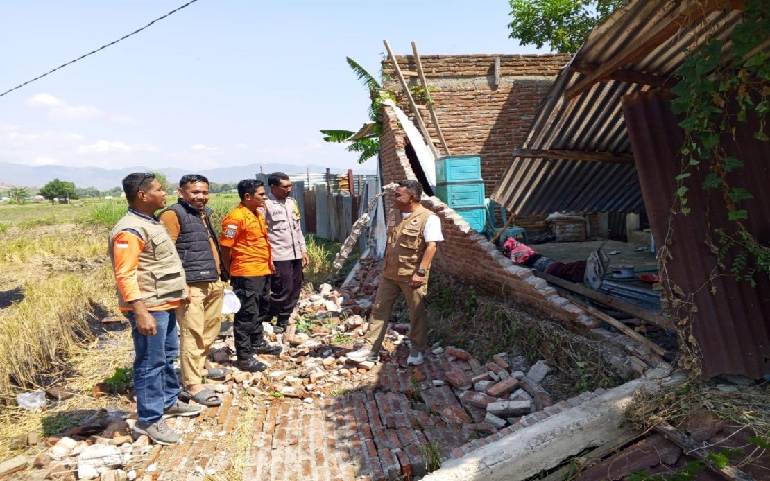
A devastating magnitude 7.7 earthquake shook Indonesia's Flores Island in East Nusa Tenggara before dawn on Saturday, claiming at least 38 lives and triggering a desperate race against time to free residents buried beneath the rubble of collapsed structures. The tremor, which struck at 4:58 am local time with its epicentre located approximately 30 kilometres from the coastal town of Mbay at a depth of 15 kilometres, has already prompted a significant humanitarian response from Indonesian authorities and emergency services.
National Disaster Management Agency chief Suharyanto reported that the casualty figures continue to mount as search operations proceed into their first full day. Beyond the confirmed deaths, two individuals sustained serious injuries while 11 others suffered minor wounds. Notably, approximately 2,000 residents have independently fled the immediate disaster zones, reducing the number requiring official evacuation assistance. However, Suharyanto emphasised that substantial rescue efforts remain the critical priority, as credible reports suggest numerous people remain trapped under damaged residential and commercial buildings throughout the affected region.
The initial tsunami warning triggered by the underwater earthquake was cancelled by 7:31 am after monitoring stations detected no dangerous sea-level fluctuations. This decision to lift the alert allowed authorities to redirect full attention and resources toward the terrestrial rescue operation rather than managing coastal evacuations. The absence of a major tsunami represented a fortunate outcome given the earthquake's substantial magnitude and proximity to populated coastal areas.
The structural damage across Flores has proven extensive. Dozens of residential dwellings have been destroyed or rendered uninhabitable, while several community health centres sustained significant damage that could hamper medical response capabilities during this critical period. Multiple sections of the island's road network have been severed by landslides triggered by the seismic activity, creating logistical challenges for rescue teams attempting to access isolated communities. However, airport runways escaped major damage, preserving vital air transport capacity for flying in emergency personnel and supplies.
The Indonesian National Search and Rescue Agency (Basarnas), working in coordination with military and police personnel, has mobilised personnel across the disaster zone to conduct systematic searches and extraction operations. Suharyanto acknowledged that both the casualty toll and extent of physical infrastructure damage remain subject to revision as field assessments progress and more affected communities report their situations. The opening hours of the disaster response typically produce incomplete data as initial reports consolidate and field teams conduct comprehensive damage surveys.
Government authorities have rapidly shifted focus toward restoring critical infrastructure that enables both rescue operations and humanitarian assistance. The Public Works Ministry has deployed machinery and workers to clear landslide debris blocking key roads, recognising that transport connectivity directly determines the speed and scope of relief distribution. Simultaneously, communications infrastructure restoration represents another urgent priority, as disabled telecommunications networks hamper coordination between emergency responders and isolated communities seeking help.
The air support component of the response includes two helicopters and a fixed-wing transport aircraft pressed into service for emergency evacuations and logistics operations. These aircraft have assumed particular significance given the damaged road network, enabling direct delivery of relief materials to communities cut off by landslides. Supplies currently being distributed encompass food provisions, potable drinking water, purified water for sanitation purposes, emergency shelter tents, electrical generators and other essential items required for immediate survival.
The earthquake's timing and magnitude place it among Indonesia's more significant seismic events in recent years, reflecting the nation's persistent vulnerability to tectonic activity along the Pacific Ring of Fire. Flores Island's position within this geologically active zone means that substantial earthquakes occur periodically, yet each event tests emergency preparedness systems and resource availability. The rapid government mobilisation in this instance demonstrates established disaster response protocols, though the scale of this particular earthquake will inevitably strain coordination mechanisms and material resources.
For regional observers and governments including Malaysia, the Flores disaster underscores the necessity of robust earthquake preparedness and rapid disaster response capabilities. Southeast Asia sits atop multiple tectonic plate boundaries, exposing numerous population centres to similar risks. The Indonesian response, despite the immediate pressures, provides instructive lessons regarding resource mobilisation, inter-agency coordination and the critical importance of maintaining air transport capability during ground infrastructure disruption. Malaysia's own earthquake preparedness frameworks and emergency response systems warrant periodic review and enhancement in light of such significant neighbouring disasters.

