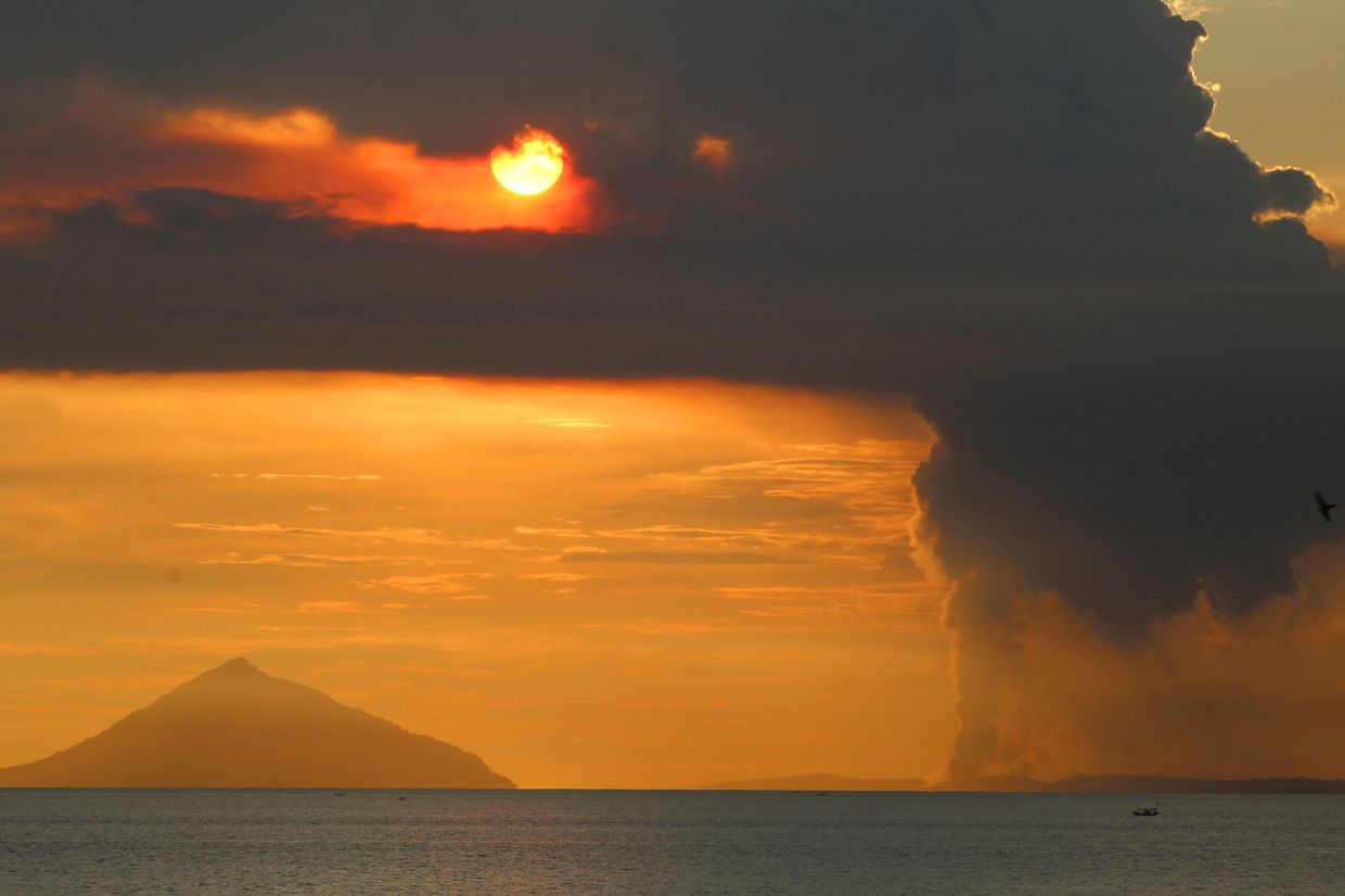
Indonesia's Mount Anak Krakatau, situated within the Sunda Strait between Java and Sumatra, erupted on Tuesday, 7 July, producing an ash plume that climbed roughly 100 metres from its crater. The Energy and Mineral Resources Ministry's Geological Agency recorded the eruption at 8:21 a.m., monitoring a dense gray column of volcanic material that drifted toward the north-west. Seismic sensors detected maximum amplitude readings of 11 millimetres with a duration of approximately 15 seconds, adding to the growing body of data documenting the volcano's recent intensification.
This latest eruption represents the fifth recorded explosive event since Mount Anak Krakatau entered its current active phase, having first erupted on Thursday following a comparatively quiet period. The pattern of escalating activity over recent weeks has prompted Indonesia's Geological Agency to take the significant step of raising the volcano's alert classification from Level II to Level III — the second-highest designation in the country's volcanic monitoring framework. The upgrade reflects official concern about the trajectory of seismic tremors and volcanic indicators, though authorities have maintained that the volcano's status would remain stable pending further developments.
Andi Suwardi, head of the Mount Anak Krakatau Observation Post in South Lampung, provided reassurances that monitoring teams continue round-the-clock surveillance of the volcano's behaviour. Despite the frequency of eruptions, Suwardi characterised the overall alert level as unchanged, noting that while activity fluctuates considerably, systematic observation of ash plume dimensions and seismic signatures continues unabated. This dual messaging—acknowledging elevated volcanic behaviour while resisting a further escalation of alert status—reflects the delicate balance authorities must maintain between transparent risk communication and avoiding unnecessary economic disruption in affected communities.
The build-up to this week's eruptions became apparent in mid-June when Mount Anak Krakatau emerged from an extended dormant phase. Beginning 10 June, monitoring stations detected a sharp uptick in volcanic signals. The situation deteriorated markedly between 18 and 19 June, when daily tremor and low-frequency earthquake counts surged beyond 50 events per day. From 16 June through 2 July, this rate nearly doubled to an average of 97 daily seismic events, establishing a clear trajectory toward the current eruptive sequence and prompting the alert level elevation on Friday.
In response to the heightened hazard, Indonesian authorities implemented a three-kilometre exclusion perimeter around the volcano's crater. This restriction aims to protect the lives of fishermen, tourism operators, and other individuals who might otherwise venture into the immediate danger zone. Despite these official boundaries, reports indicate that some fishing communities and tourism entrepreneurs have continued to operate in nearby waters, evidently weighing short-term income needs against the documented risks. This persistent incursion into restricted areas underscores the tension between subsistence livelihoods and volcanic safety protocols in a region economically dependent on the sea.
South Lampung Regent Radityo Egi Pratama appealed directly to the fishing and tourism industries to observe the safety restrictions voluntarily. Acknowledging the economic hardship imposed by volcanic unrest on communities reliant on marine resources and tourism revenue, Pratama nevertheless emphasised that public welfare must supersede commercial interests during periods of elevated hazard. His statement captured the difficult position facing local officials tasked with enforcing safety measures in economically vulnerable populations for whom temporary income loss poses genuine hardship.
Mount Anak Krakatau's geological history adds considerable weight to these precautionary measures. The volcano emerged from the sea in 1927, arising within the vast caldera left behind by the catastrophic 1883 eruption of its parent volcano, Mount Krakatau. That nineteenth-century disaster stands as one of humanity's deadliest natural calamities, with explosions and associated tsunamis claiming an estimated 36,000 lives throughout the region. The eruption ejected such immense quantities of volcanic ash that global climate patterns shifted measurably in subsequent years, a reminder of the vast energies contained within the Sunda Strait's volcanic structures.
More recently, Mount Anak Krakatau demonstrated its destructive potential on 22 December 2018, when a partial flank collapse triggered a tsunami that ravaged coastal communities in southern Sumatra and western Banten. That event resulted in at least 429 deaths and over 7,200 injured, establishing Mount Anak Krakatau as a contemporary threat rather than a historical curiosity. The 2018 disaster occurred with relatively limited warning, prompting Indonesian authorities to refine monitoring protocols and public communication strategies for this particular volcano.
The current sequence of events carries particular significance for Southeast Asian regional disaster management. Mount Anak Krakatau's position at the confluence of major shipping lanes and adjacent to densely populated coastal regions means that sudden, severe activity poses risks extending beyond Indonesia's borders. Malaysia, with significant maritime traffic through the Sunda Strait and populations in peninsula areas within potential tsunami range, maintains indirect but material stakes in Indonesian volcanic monitoring and response capabilities. The volcano's behaviour thus represents not merely a domestic Indonesian concern but a test of regional preparedness frameworks.
Government messaging has attempted to calibrate public response carefully, avoiding both complacency and panic. By maintaining Level III alert status rather than elevating to the highest Level IV, authorities signal that the situation, while serious, does not yet warrant the most extreme emergency responses. However, the three-kilometre exclusion zone and sustained 24-hour monitoring reflect genuine concern about potential escalation. This measured approach requires that local populations and economic actors accept restrictions based on scientific judgment rather than observable immediate threat—a demanding ask in communities where fishing or tourism income cannot easily be deferred.
Looking ahead, the trajectory of Mount Anak Krakatau's activity over coming days and weeks will determine whether current restrictions remain adequate or whether further escalation becomes necessary. The Geological Agency's monitoring teams possess sophisticated seismic equipment and considerable experience with Indonesian volcanoes, yet volcanic behaviour often contains unpredictable elements. Authorities have explicitly urged public vigilance regarding any sudden changes and emphasised that recommendations could be adjusted based on new data. For residents and businesses in the surrounding region, this period of elevated volcanic activity underscores the ongoing geological dynamism that shapes life in the Indonesian archipelago.

