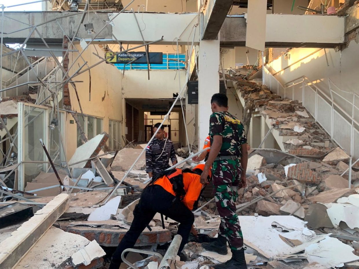
A powerful magnitude 7.7 earthquake struck off the coast of Indonesia's Flores region early on Saturday, August 15, triggering widespread destruction and claiming at least two lives in an area long accustomed to seismic upheaval. The tremor, which struck at 5:58 a.m. local time with its epicenter located 68 kilometres north-northwest of the city of Ende in East Nusa Tenggara province, sent shock waves across the island and sparked immediate emergency responses from authorities and rescue services scrambling to assess the damage.
According to the U.S. Geological Survey, the earthquake originated at a shallow depth of just 10 kilometres beneath the ocean floor, a characteristic that typically amplifies the intensity of ground shaking in populated areas. The initial violent rupture was followed by multiple aftershocks that continued to rattle the region and heighten anxiety among residents already traumatised by the main quake. The Maumere Search and Rescue Agency reported that besides the two fatalities, two additional people sustained injuries as buildings crumbled and infrastructure buckled under the tremendous seismic forces unleashed across Flores island.
The response from Indonesian authorities reflected the immediate and serious nature of the threat posed by undersea earthquakes in this region. Officials with the nation's Meteorology, Climatology and Geophysics Agency initially issued tsunami warnings covering parts of East Nusa Tenggara, West Nusa Tenggara, South Sulawesi and Southeast Sulawesi provinces, urging residents in low-lying coastal areas to evacuate to higher ground and stay away from beaches and riverbanks. However, after closely monitoring sea-level activity in the aftermath of the quake, the agency determined that no significant changes had occurred and subsequently withdrew the warning, sparing the region from what could have been a catastrophic secondary disaster.
The physical destruction wrought by the earthquake was evident from eyewitness accounts and television footage emerging from affected areas. Hospital staff responded swiftly by evacuating patients from buildings and establishing makeshift treatment facilities in outdoor spaces, setting up beds, intravenous stands and oxygen cylinders in temporary structures as a precautionary measure. Yohanna Embu, a resident of Sikka regency, described witnessing numerous damaged structures throughout the community, including the collapse of the waiting room at Maumere's port terminal. Her account underscored how the quake's force affected not only residential buildings but also critical infrastructure used daily by thousands of people.
The impact extended to religious institutions on the predominantly Catholic island. Students and nuns at St. Peter Major Seminary, locally known as Ritapiret Seminary, were attending morning Mass in an assembly hall when the roof suddenly gave way, forcing them to flee in panic. Rev. Guidelbertus Tanga, the seminary's rector, reported that at least one priest suffered a broken leg after jumping from the second floor of a building while attempting to escape the collapsing structure. Such incidents highlighted the indiscriminate and sudden nature of earthquake damage, affecting both civilian populations and those serving in institutional roles.
Indonesia's vulnerability to major seismic events stems from its geographical position within the Pacific Ring of Fire, an extensive arc encompassing numerous volcanoes and tectonic fault lines that girdle the Pacific Basin. The nation, consisting of more than 17,000 islands stretched across a vast equatorial expanse, sits atop a complex system of convergent plate boundaries where the Indo-Australian Plate collides with the Eurasian Plate. This geological setting makes Indonesia one of the world's most seismically active regions, where powerful earthquakes and volcanic eruptions occur with troubling regularity and pose ongoing risks to millions of inhabitants.
The historical record serves as a sobering reminder of the catastrophic potential residing beneath Indonesia's seabed. In December 1992, the Flores region experienced a devastating earthquake that generated a tsunami claiming approximately 2,500 lives across the southeastern island. That tragedy, one of the deadliest seismic events in modern Indonesian history, established a precedent that shaped public and official responses to subsequent earthquakes in the region, explaining the swift evacuation orders and urgent warnings issued following Saturday's tremor.
The August 15 earthquake represents the latest reminder of the persistent seismic hazard facing Indonesia and the broader Southeast Asian region. For Malaysia, which shares the same Pacific Ring of Fire influence across its eastern territories and maritime zones, the incident underscores the importance of maintaining robust earthquake early warning systems and disaster preparedness frameworks. The successful deployment of monitoring technology to quickly rule out tsunami danger demonstrates how science-based institutional responses can mitigate secondary hazards even when primary damage from ground shaking cannot be prevented.
Regional geological and disaster management experts continue to analyse the earthquake's characteristics and its implications for understanding seismic behaviour along Indonesia's subduction zones. The relatively shallow depth and moderate magnitude of Saturday's quake, combined with its ability to cause significant structural damage, reflects the complex interplay between fault geometry, rock composition and population density that determines how seismic energy translates into human impact. As Indonesia continues to develop its infrastructure and accommodate growing populations, the integration of earthquake-resistant building standards and improved monitoring capabilities remains essential for reducing casualties and preserving livelihoods across this earthquake-prone archipelago.

