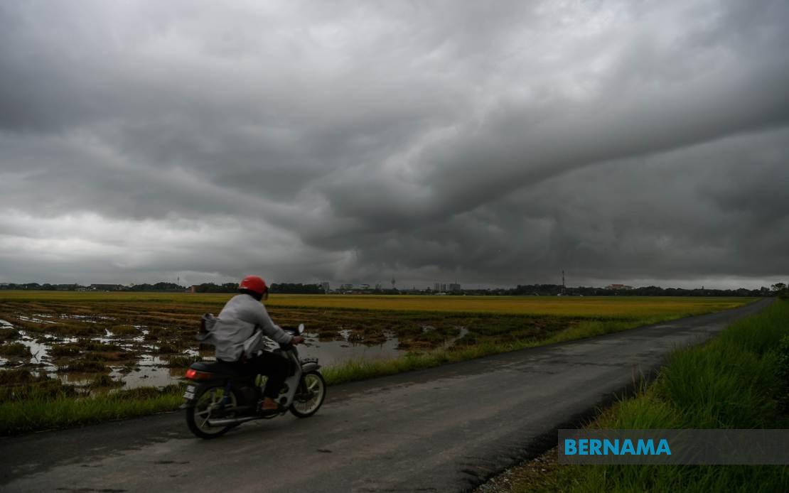
The Malaysian Meteorological Department (MetMalaysia) has activated a nationwide weather alert, cautioning residents across multiple states to prepare for severe thunderstorms, torrential rainfall and dangerous wind gusts expected to dominate the atmospheric landscape through the evening of July 15. The warning, which extends across Peninsular Malaysia and both East Malaysian states, underscores the volatile monsoon conditions currently affecting the region and highlights the need for public vigilance during peak storm activity hours.
In the northern corridor, the warning encompasses a significant portion of Kedah's landscape, specifically targeting the districts of Kuala Muda, Baling, Kulim and Bandar Baharu. The alert extends southward through Penang, where all four major administrative divisions face potential impact: the Northeast district, Seberang Perai Utara, Seberang Perai Tengah and Seberang Perai Selatan. This broad coverage suggests meteorologists have detected a weather system with considerable geographical reach, necessitating precautionary measures across the entire state.
Perak faces an equally extensive threat, with nine districts receiving the alert. The warning stretches from the northwestern districts of Kerian, Larut, Matang and Selama through the central highlands around Hulu Perak and Kuala Kangsar, extending into the populous Kinta and Kampar regions and concluding in the southern segment with Batang Padang. Meanwhile, Kelantan stands alone in receiving statewide coverage, indicating that meteorologists expect the weather system to affect all populated areas throughout the state without geographical discrimination.
In Terengganu, six districts have been placed under alert: Besut and Hulu Terengganu in the north, the state capital Kuala Terengganu and its adjacent regions of Marang, Dungun and Kemaman. Pahang's alert focuses on six districts as well, though distributed across the state's varied topography—from the elevated Cameron Highlands through the central districts of Lipis and Jerantut, to the coastal areas of Kuantan, Pekan and Rompin. This pattern reflects the likelihood that the storm system will penetrate inland and affect both highland and lowland communities.
Johor's warning network encompasses eight districts, spanning from the western upland regions of Tangkak and Segamat through the central areas of Muar and Kluang, to the eastern districts of Mersing and Kota Tinggi, and finally the developed zones of Kulai and Johor Bahru. The scale of coverage in Malaysia's southernmost peninsula state suggests the weather disturbance possesses sufficient intensity and breadth to impact the entire state structure.
In East Malaysia, Sarawak's alert covers five distinct areas, concentrated in the central and coastal regions. Sibu and the Mukah region, which encompasses Matu and Dalat, represent the southern coverage, while Kapit's Song district and Bintulu's Tatau subdivision extend the warning northward. Miri's districts of Beluru, Miri and Marudi complete the Sarawakian coverage, indicating the storm system is expected to traverse substantial portions of the state.
Sabah's alert demonstrates a dual geographic focus, with communities in both the Interior and West Coast divisions receiving warnings. The Interior Division alert encompasses Sipitang, Kuala Penyu, Beaufort and Tambunan, while the West Coast region faces potential impact in Papar, Penampang and Ranau. The Federal Territory of Labuan also features in the alert, expanding the geographic scope to encompass Sabah's offshore jurisdiction. This distribution pattern suggests that residents across both Sabah's mainland and island territories should prepare for severe weather conditions.
The geographical breadth of this alert—spanning from Kedah in the far north to Johor in the south, and extending across both major East Malaysian states—reflects the scale and intensity of the weather system currently moving through Malaysian airspace. Such comprehensive coverage is relatively uncommon and typically indicates a significant atmospheric disturbance capable of generating multiple severe weather phenomena simultaneously across vast distances.
For residents across these affected regions, the MetMalaysia warning carries several practical implications. The combination of thunderstorms, heavy rainfall and strong winds creates multiple hazards: lightning poses immediate electrocution risks, torrential rain may trigger flash flooding in low-lying areas and alongside waterways, while strong winds can dislodge loose structures and fell weakened trees. Public transportation, particularly air and maritime services, may experience disruptions, while outdoor activities and events should be postponed or relocated indoors.
The concentration of warnings through the evening hours—until 9pm—suggests that atmospheric instability is expected to peak during this period. Residents should monitor MetMalaysia updates closely, as conditions may change or expand beyond the currently indicated areas. Those in rural or flood-prone districts should exercise particular caution, as rapid-onset flooding following heavy downpours remains a persistent hazard in Malaysian communities.
This alert reinforces the ongoing weather volatility that characterizes Malaysia's monsoon season, when atmospheric pressure systems and moisture-laden winds converge to create the ideal conditions for severe thunderstorm development. The pattern of repeated alerts across the region underscores the importance of maintaining updated weather awareness and heeding official guidance from meteorological authorities. Residents should ensure their homes and workplaces are prepared for potential weather impacts, including securing outdoor items and maintaining emergency supply kits.
MetMalaysia's detailed geographic breakdown, rather than issuing a blanket national warning, demonstrates the agency's sophisticated understanding of atmospheric patterns and their regional manifestations. This precision-targeted approach allows residents in unaffected areas to proceed with normal activities while those in threatened zones can implement appropriate protective measures. Continued monitoring of official weather updates through the evening will provide clarity on whether conditions develop as forecast or whether the severity moderates.

