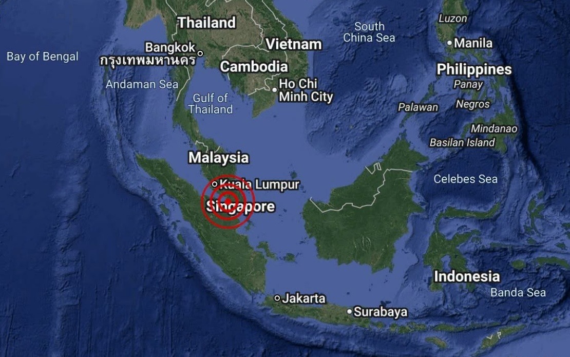
A minor seismic event registered off the southern coast of Johor on Monday afternoon, with the Malaysian Meteorological Department recording a magnitude 3.1 earthquake in the waters adjacent to Batu Pahat. The tremor struck at 4.12 pm local time, with its epicentre positioned approximately 18 kilometres southwest of the town, at coordinates 1.7 degrees north and 102.8 degrees east.
The National Weather and Earthquake Operations Centre, which functions as MetMalaysia's primary seismic monitoring authority, swiftly issued a public advisory following the incident. Officials confirmed that the offshore location and moderate intensity of the quake presented no hazard to Malaysian territories, and crucially, posed no risk of triggering any tsunami waves that might endanger coastal communities across the country.
Earthquakes of this magnitude are relatively common in Southeast Asian waters, occurring within the broader tectonic framework that characterizes the region. The Batu Pahat area, situated along the western coast of Peninsular Malaysia facing the Strait of Malacca, sits in a zone where minor seismic activity is periodically recorded. Such events rarely cause concern among residents or disrupt normal activities, as the energy released remains insufficient to generate significant ground motion or structural damage.
Malaysia's earthquake monitoring capabilities have expanded considerably over recent decades, with MetMalaysia maintaining a network of seismic stations distributed across the peninsula and East Malaysia. This infrastructure enables rapid detection and analysis of tremors, allowing authorities to communicate timely assessments to the public and relevant agencies. The speed with which officials provided their no-tsunami-threat statement reflects the efficiency of these monitoring systems and established protocols for public communication during seismic events.
The broader region encompassing Peninsular Malaysia and surrounding waters experiences periodic seismic activity driven by regional geology and plate tectonics. While the country lies outside the major subduction zones that generate the most powerful earthquakes affecting Southeast Asia, such as those in Sumatra, the Philippines, or the Java Trench, localized earthquake activity remains an ongoing reality. Understanding this context helps residents appreciate why authorities maintain continuous vigilance and why public notification systems exist.
Tsunami warnings represent a particularly significant concern in this region, given the devastating 2004 Indian Ocean tsunami that killed thousands across multiple countries. Since that catastrophe, early warning systems and public education initiatives have become standard across maritime Southeast Asia. MetMalaysia's immediate confirmation that no tsunami threat existed would have provided reassurance to residents in coastal Johor, particularly those in Batu Pahat and nearby communities like Kota Tinggi.
The incident underscores the importance of maintaining robust disaster preparedness infrastructure in a region prone to natural hazards. While most earthquakes cause minimal disruption, the potential for more significant events means that governments and specialized agencies must remain equipped to detect, analyze, and communicate seismic information effectively. For Malaysian citizens, particularly those in coastal areas, familiarizing themselves with emergency procedures and official communication channels during natural disasters remains a prudent precaution.
Public awareness campaigns about earthquake safety and tsunami response procedures have become increasingly common throughout Malaysia in recent years. These educational efforts help ensure that when seismic events occur, residents understand appropriate responses and can distinguish between routine tremors and genuine emergency situations requiring evacuation or shelter measures. The Monday incident, while minor, serves as a reminder of the importance of such preparedness initiatives.
Monitoring and responding to seismic activity falls within a broader framework of disaster management that encompasses multiple natural hazards affecting Malaysia. Alongside earthquakes and tsunamis, the country faces risks from flooding, landslides, and other weather-related phenomena. Integrated emergency management systems that coordinate across these various threats have become increasingly sophisticated, with better data sharing between federal, state, and local authorities ensuring comprehensive public protection.
Looking forward, continued investment in seismic monitoring technology and research will likely enhance Malaysia's ability to detect and analyze earthquake activity with even greater precision. Collaborative efforts with regional neighbors and international seismic research institutions contribute to a shared understanding of earthquake patterns across Southeast Asia, benefiting public safety across the entire region.

