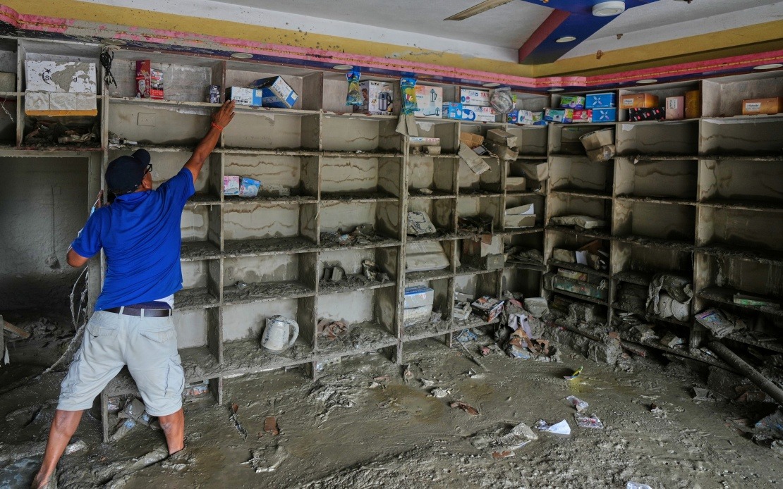
A transboundary geological disaster has claimed at least 16 lives and left 546 people missing after an ice-rock avalanche from Nepal's Mount Langtang Lirung glacier descended rapidly across the border and evolved into a massive mudslide that devastated Gyirong Port in China's Xizang Autonomous Region. The Xizang regional government confirmed the causal link on Sunday, drawing on detailed scientific analysis to explain how a natural phenomenon originating in one nation triggered catastrophic consequences in another, underscoring the shared environmental vulnerabilities that characterise the Himalayan borderlands.
The disaster sequence began when a glacier on the south slope of Mount Langtang Lirung fractured at approximately 5,200 metres elevation, releasing a cascade of ice and rock that initiated the avalanche. The initial collapse, though occurring within Nepalese territory, set in motion a chain reaction that would traverse the mountainous terrain with devastating speed and accumulating force. Scientists emphasise that such events, while rare, represent a genuine hazard in high-altitude regions where glacial stability is increasingly affected by broader environmental changes.
As the avalanche descended rapidly over a vertical distance of more than 1,200 metres, gravitational acceleration combined with the tumbling mass of debris to create conditions favourable for transformation into a debris flow. By the time the avalanche had descended to roughly 4,000 metres altitude, it had already scoured vast quantities of additional material from the mountainside—soil, rock fragments, vegetation, and anything else in its path. This scouring process is critical to understanding why the initial avalanche evolved into something far more destructive: a debris flow that grew in volume and momentum as it descended.
The resulting mudslide, now enriched with terrestrial material from along its path, continued its downward rush across approximately 22 kilometres of terrain before reaching Gyirong Port, situated at around 1,800 metres elevation. The sheer distance travelled by this debris flow, combined with the vertical drop it had negotiated, demonstrates the enormous energy inherent in such events. For communities situated in low-lying valleys adjacent to high glaciated peaks, the threat posed by such phenomena remains ever-present, regardless of international borders or administrative boundaries.
The physical destruction wrought by the mudslide was extensive and concentrated. The disaster flattened approximately 0.7 square kilometres of developed area, obliterating 27 buildings and associated infrastructure within Gyirong Port. Such precise destruction patterns reflect the channelled nature of debris flows, which follow natural gullies and watercourses downslope, concentrating their destructive force along specific corridors rather than dispersing uniformly across the landscape. The targeting of built structures suggests that Gyirong Port's development had followed the natural drainage patterns that channelled the debris flow.
The identification of the source and mechanism came through coordinated scientific investigation undertaken by the Institute of Mountain Hazards and Environment, an organisation operating under the Chinese Academy of Sciences. Their analysis incorporated multiple complementary data streams, including remote-sensing satellite monitoring that captured the event's progression across the landscape, real-time field data transmission from instruments deployed in the affected region, and comprehensive on-site investigations conducted by trained scientific personnel. This multi-method approach enabled researchers to trace the debris flow backwards to its origins, establishing with confidence that the triggering event occurred within Nepalese territory.
The identification of the source glacier on Mount Langtang Lirung carries particular significance for South Asian environmental monitoring. The Langtang Range, which straddles the Nepal-China border, contains numerous glaciers that feed river systems vital to millions of people across the region. Understanding the failure mechanisms and triggers for glacial collapse in this area helps inform risk assessment protocols for communities downstream, whether in Nepal or along the Tibetan plateau. The cross-border nature of this disaster illustrates how environmental phenomena respect no political boundaries, creating shared vulnerabilities that demand coordinated regional approaches.
For Malaysia and other Southeast Asian nations, this incident offers instructive lessons about the potential for geological hazards to trigger cascading disasters in mountainous terrain. While Malaysia's equatorial location and geological characteristics differ substantially from the Himalayas, the fundamental principle—that natural hazards in upland regions can propagate downslope with devastating consequences for populated lowlands—applies universally. Communities throughout Southeast Asia situated in valleys downstream from mountainous regions should be mindful of similar risks, particularly given ongoing climate-related changes affecting snow and ice dynamics.
The timing of the disaster, occurring at the cusp of late August as monsoon seasons transition across South Asia, raises questions about seasonal factors in glacial stability. Some researchers hypothesise that rapid temperature fluctuations during transitional seasons can create stress concentrations within glacial ice that precipitate collapse events. However, the Institute of Mountain Hazards and Environment has not yet publicly detailed whether seasonal or other climatic factors specifically contributed to the August 26 failure.
The humanitarian toll—16 confirmed dead with 546 individuals unaccounted for—represents only one dimension of the disaster's impact. The destruction of 27 buildings means the loss of residences, commercial establishments, and infrastructure serving the Gyirong Port community. Recovery and reconstruction will require substantial resources and sustained effort. The psychological and social impacts on surviving residents and missing persons' families extend far beyond what immediate casualty figures convey.
Geologically, this event reinforces the precarious equilibrium that characterises high-mountain environments. Mount Langtang Lirung and its surrounding glaciers exist in a state of dynamic flux, responding to long-term climate patterns and short-term weather variations. The fracture that triggered this disaster suggests that the internal stress regime within that particular glacier had accumulated to a critical threshold, whereupon sudden failure became inevitable. Whether the glacier's destabilisation resulted primarily from secular warming trends, seasonal temperature swings, or other geophysical factors remains a subject for ongoing scientific investigation.
The transboundary implications of this disaster underscore the need for enhanced cooperation between Nepal and China in monitoring high-altitude hazards and sharing early-warning information. Neighbouring countries whose territories interface along mountainous frontiers benefit from coordinated hazard surveillance systems that can detect incipient failures before they mature into full-scale disasters. Such cooperation, while challenging to implement given geopolitical complexities, ultimately serves humanitarian purposes that transcend political considerations.
Looking forward, the detailed analysis of this event will inform scientific understanding of how glacial failures transition into catastrophic debris flows, knowledge applicable across the Himalayan region and other high-mountain environments worldwide. The lessons emerging from Gyirong Port will enhance emergency preparedness in similarly vulnerable locations, potentially saving lives through improved hazard forecasting and community preparation protocols.

