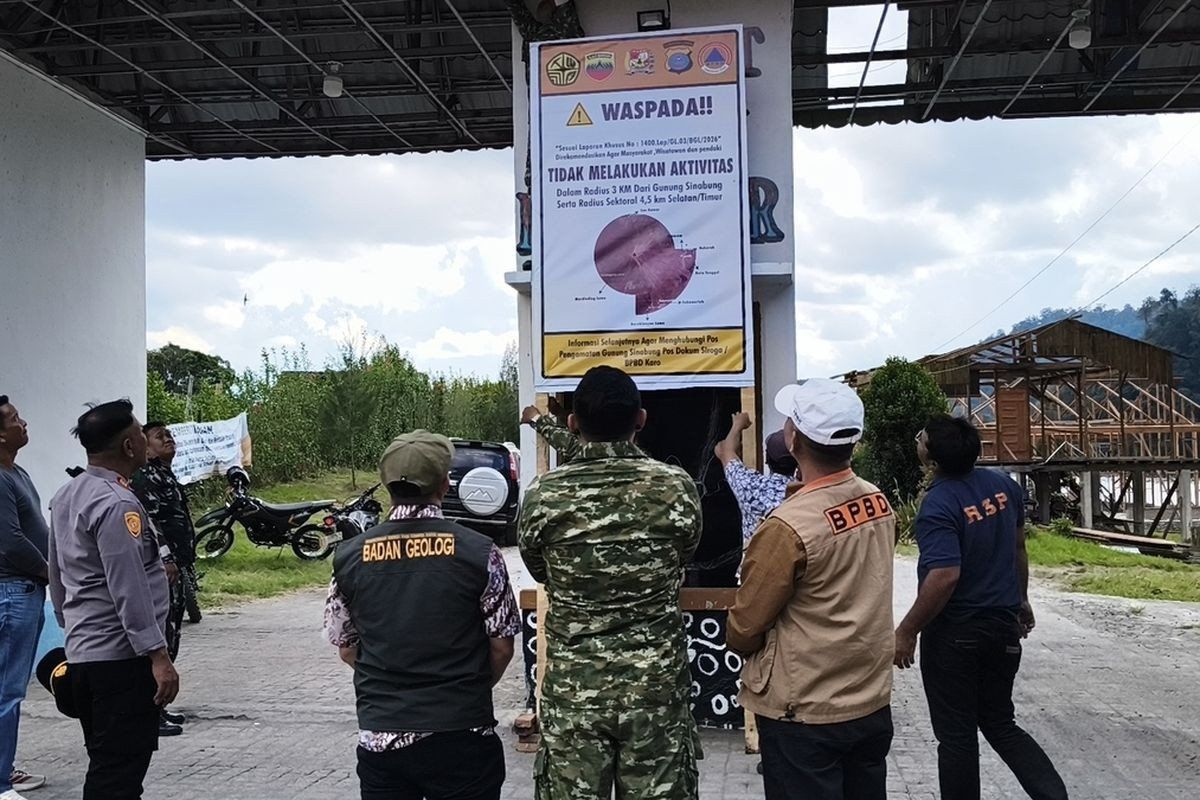
The Karo regency administration in North Sumatra has shuttered access to Lau Kawar Lake and its adjacent camping facilities in Kuta Gugung village effective August 19, responding to escalating signs of volcanic unrest at Mount Sinabung. The indefinite suspension of recreational activities at the mountain's slopes reflects growing official concern about the volcano's behaviour, with the closure decision anchored in direct advice from Indonesia's Vulcanology and Geological Disaster Mitigation Center. Karo Youth Affairs, Sports and Tourism Agency chief Juni Antomi Kemit confirmed the precautionary measure was intended to shield both resident communities and the travelling public from potential hazards as the 2,460-metre peak enters a new phase of destabilization.
Official warnings about Mount Sinabung's elevated threat level predate the tourism closure by several days. On August 14, the Karo regent had already issued a public notice instructing residents, visitors, and mountaineers to cease all activity in the volcano's vicinity, a signal that regional authorities were tracking concerning developments. Juni's remarks on August 26 characterised the Lau Kawar Lake shutdown as a deliberate safeguard, emphasizing that heightened volcanic behaviour had necessitated the action. The timing of these announcements underscores how quickly Indonesian disaster management officials can move when geological monitoring data suggests imminent risk, a capability tested repeatedly over Mount Sinabung's recent eruptive history.
The technical basis for escalating readiness becomes clearer through statements from Armen Putra, who heads the Mount Sinabung monitoring post. He disclosed that the alert classification had been upgraded from Level I (Normal) to Level II Waspada (Advisory) within Indonesia's four-tier warning system—a meaningful jump that signals measurable change in subsurface conditions. Under the new advisory status, authorities recommend that no one venture within three kilometres of the summit, while the southeastern sector extends the exclusion radius to 4.5 kilometres, reflecting understanding that pyroclastic flows and lahars pose directional hazards. The August 13 advisory specifically cautioned residents occupying riverbanks fed by upstream Mount Sinabung drainage to remain alert for potential mud flow events, a concern rooted in the volcano's capacity to rapidly mobilize loose volcanic material during eruptive episodes.
Seismic data collected in late August paint a portrait of intensifying underground activity. By Thursday morning, August 27, the monitoring station recorded five volcanic earthquakes originating beneath Mount Sinabung, supplemented by additional tectonic tremors—a marked increase from Wednesday's count of one volcanic and seven tectonic quakes. Armen warned that the rising frequency of seismic events correlates with mounting eruption potential, a principle grounded in decades of volcanological observation. Visible manifestations accompanied this underground restlessness: thick smoke plumes rose between 100 and 800 metres above the summit, a sign that hot gases and ash were being expelled from the volcano's vent system. This combination of instrumental and observable evidence prompted officials to take the advisory level declaration seriously rather than dismiss it as a precautionary formality.
Mount Sinabung's eruptive record over the past fourteen years illustrates why such vigilance remains justified. The volcano had lain dormant for approximately four centuries before its initial modern eruption on August 29, 2010, surprising communities that had lived in its shadow without recent volcanic disruption. That initial event proved relatively brief, with activity declining by September 2010. A second eruption cycle commenced on September 15, 2013, though the volcano's behaviour again moderated within two weeks. However, November 2013 brought a substantially more violent episode that elevated the alert status to Level IV Awas (Warning)—the system's highest category. This major eruption killed numerous people through pyroclastic flow impacts and forced the evacuation of residents from 21 villages and two hamlets, demonstrating Mount Sinabung's capacity for destructive events when conditions align.
Following the 2013 crisis, Mount Sinabung entered a prolonged eruptive phase that persisted for six consecutive years, keeping communities on heightened alert throughout that decade-long period. By May 2019, analysis of visual observations and instrumental monitoring suggested that the immediate threat had diminished sufficiently to warrant downgrading the alert to Level III Siaga (Watch)—still cautious but less restrictive than the warning category. This extended period of relatively stable, lower-level activity might have created a false sense of security among tourism operators and visitors. The situation shifted dramatically on July 28, 2021, when Mount Sinabung erupted again after months of relative calm. That eruption ejected volcanic ash to altitudes of 4,500 metres and sent pyroclastic flows eastward and southeastward for distances exceeding one kilometre, affecting at least five districts with heavy ashfall that contaminated wide areas.
The 2021 eruption represented the volcano's most significant activity in the eleven-year period since the 2010 initial eruption, reminding observers that Mount Sinabung remains an active geological hazard despite periods of quiescence. With that recent precedent in mind, current rises in seismic frequency and visual volcanic output take on added significance for emergency managers. The closure of tourism infrastructure like Lau Kawar Lake and associated facilities reflects institutional memory of what Mount Sinabung proved capable of unleashing in 2013 and 2021. Unlike dormant volcanoes that might tolerate recreational use, Mount Sinabung has demonstrated a pattern of episodic but sometimes violent activity that makes any sign of renewed unrest a serious matter requiring immediate attention.
For Malaysian travellers and regional tourism operators with connections to North Sumatra, the restrictions carry practical implications. Lau Kawar Lake and the surrounding Kuta Gugung area had attracted visitors seeking natural attractions in the Karo highlands, particularly trekking enthusiasts and those interested in volcano-related tourism. The indefinite closure means alternative itineraries must be developed for holiday planners and tour companies. More broadly, the situation illustrates how volcanic hazards can suddenly reshape tourism geography in Southeast Asia, where numerous populated regions sit near active or potentially active volcanic systems. While Indonesian authorities have well-established protocols for volcano monitoring and public communication, the speed with which conditions can change—as Mount Sinabung's history demonstrates—keeps regional tourism planning in a state of perpetual adjustment.

