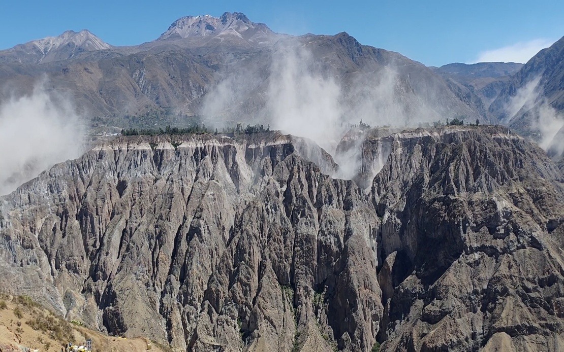
Southern Peru endured a significant seismic event on Thursday afternoon when a powerful earthquake measuring 6.7 magnitude jolted the region, prompting alert systems across multiple provinces. The US Geological Survey documented the tremor, while Peru's Geophysical Institute (IGP) initially recorded the magnitude at 7.2 on its scale, both reflecting slightly different methodologies in measurement but confirming the considerable strength of the event that rippled through the country's populated zones.
The National Seismological Centre of the IGP pinpointed the epicentre approximately 35 kilometres north of Coracora, a municipality within Parinacochas province located in the Ayacucho department of the southern highlands. The tremor occurred at 1 pm local time and originated at an intermediate depth of 108 kilometres beneath the earth's surface, a critical factor that ultimately determined the impact felt by millions of residents across the nation.
The depth of the earthquake proved instrumental in mitigating surface damage. Geophysicists explained that the considerable distance between the hypocenter and ground level allowed substantial energy dissipation through rock layers, considerably reducing the violence experienced at surface level. The resulting Mercalli intensity rating near the epicentre was assessed as III-IV, classified as "light to moderate shaking," a relatively modest designation for a tremor of such magnitude, underscoring how depth fundamentally alters seismic consequences.
Despite the high magnitude reading and the broad geographical area affected, Peruvian disaster management agencies and local authorities have reported no fatalities or significant structural damage in the immediate aftermath. This positive outcome reflects both the advantageous depth of the earthquake and the generally robust construction standards that have been progressively implemented across the nation following earlier devastating events. The absence of casualties from such a powerful tremor represents an important validation of Peru's improved disaster preparedness infrastructure.
Residents across southern and central Peru experienced clearly perceptible shaking, with the earthquake detected as far north as Lima, the capital city located over 500 kilometres away. This widespread distribution of effects, despite the moderate Mercalli rating, demonstrates how intermediate-depth earthquakes can transmit energy across extensive distances with diminishing but still noticeable intensity. Thousands of residents in multiple regions would have felt movement, prompting immediate protective responses and reinforcing public awareness of seismic vulnerability.
The timing of this earthquake is significant given Peru's location on the Pacific Ring of Fire, a geological zone characterised by persistent tectonic instability and frequent seismic activity. This positioning subjects the country to regular earthquakes of varying magnitudes, making seismic preparedness an integral component of national risk management strategy. The Thursday event exemplifies the ongoing geological processes that shape Peru's physical landscape and pose regular challenges to public safety.
Historical context adds weight to current safety concerns. The 2007 earthquake that devastated the Ica region measured 7.9 in magnitude and resulted in nearly 600 deaths, serving as a sobering reminder of seismic activity's destructive potential when conditions align unfavourably. That disaster prompted substantial revisions to building codes and emergency protocols, improvements that clearly contributed to the better outcomes observed this week. The memory of 2007 informs contemporary approaches to earthquake risk reduction across Peru.
The recent tremor follows a broader pattern of elevated seismic activity detected across both Peru's northern and southern regions. Geologists have observed an increase in measurable seismic events, though determining whether this represents a genuine surge or simply improved monitoring capabilities remains debated among specialists. Regardless, the pattern has elevated public consciousness regarding earthquake risks and the necessity of maintaining vigilant preparedness practices.
Responding to the Thursday earthquake and the broader seismic environment, the IGP has issued comprehensive guidance to the public. Officials have specifically urged residents to review household evacuation plans, ensuring family members understand designated safe locations and meeting points. The emphasis on preparation reflects recognition that despite improved infrastructure, earthquakes remain inherently unpredictable phenomena requiring proactive individual and community-level responses.
Beyond evacuation protocols, the IGP has encouraged households to assemble and maintain emergency supply kits containing essential items including water, non-perishable food, first aid materials, flashlights, and portable radios. These kits represent straightforward but crucial components of disaster preparedness, providing resources during the critical period following a significant earthquake when normal supply chains may be temporarily disrupted. Public health authorities emphasise that such preparations can substantially improve survival outcomes and reduce suffering during post-disaster periods.
For regional observers, Peru's seismic experience offers instructive lessons relevant across Pacific Ring of Fire countries including Indonesia, the Philippines, and Chile. The contrast between Thursday's high-magnitude tremor and minimal casualties underscores how geological factors like epicentre depth interact with human infrastructure to determine actual impact. This distinction between theoretical magnitude and practical consequences remains central to understanding earthquake risk and designing effective mitigation strategies throughout Southeast Asia and beyond.

