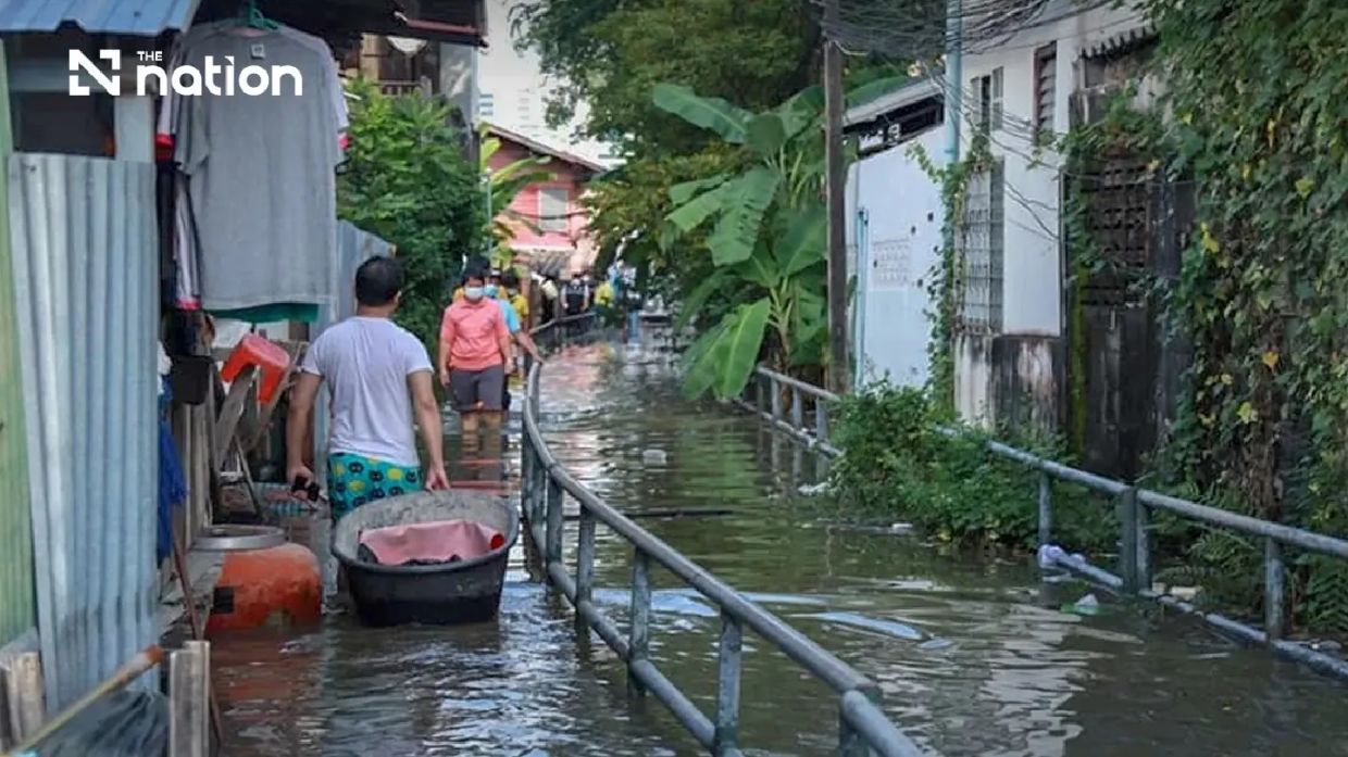
Thailand's Department of Disaster Prevention and Mitigation has placed seven administrative areas on high alert as officials brace for dangerous water conditions expected to surge through the country's central heartland during the week of July 13 to 19. The alert encompasses Bangkok alongside Pathum Thani, Nonthaburi, Nakhon Pathom, Samut Sakhon, Samut Songkhram and Samut Prakan—an expansive band of territory that forms the economic and demographic centre of the nation. The warning was issued on July 11 as monitoring data from the Royal Thai Navy's Hydrographic Department indicated water levels would reach concerning heights, particularly between 6pm and 10pm during the alert period.
The anticipated surge represents a compound flooding hazard, as exceptionally high tides are expected to overwhelm the Chao Phraya River's capacity near Phra Chulachomklao Fort and surrounding zones. This phenomenon occurs regularly as astronomical tides reach their monthly peaks, but seasonal factors and monsoon patterns can amplify the effect, transforming routine tidal cycles into genuine infrastructure threats. Theerapat Kachamat, the DDPM's director-general, emphasised that authorities would maintain continuous surveillance of hydrographic data to provide timely updates as conditions develop. The agency stressed that accurate timing of peak water levels—narrowed to a four-hour window each evening—allows communities to implement protective measures and curtail outdoor activities in vulnerable zones.
Specific districts face elevated risk across each province. In Pathum Thani and Nonthaburi, municipalities and outlying districts including Sam Khok, Pak Kret and Bang Kruai have been flagged as zones where river overflow could inundate neighbourhoods. Nakhon Pathom's Bang Len, Nakhon Chai Si and Sam Phran districts present similar hazards, while Samut Songkhram—smallest and most water-exposed of the provinces—faces risk throughout its territorial extent. Samut Prakan, which straddles the Chao Phraya's mouth where it flows toward the Gulf of Thailand, has multiple districts identified as susceptible: Mueang Samut Prakan, Phra Samut Chedi, Phra Pradaeng and Bang Bo. The concentration of at-risk zones along waterways reflects how low-lying geography dominates the central region's topology.
The principal concern centres on inundation of inadequately defended areas. Communities positioned outside engineered flood barriers, riverside settlements lacking permanent protective infrastructure, and low-lying neighbourhoods in proximity to canals and river systems face the greatest exposure. Water overflowing from riverbanks and rising levels within connected canal networks could deposit significant volumes of seawater into residential areas, commercial precincts and agricultural zones. Such flooding, even when temporary, damages property, disrupts commerce and poses health risks through contamination and vector-borne disease proliferation.
Provincial administrators have received explicit instructions to amplify public awareness regarding the high-tide phenomenon and its timing. Business operators—particularly those managing floating establishments such as riverside restaurants and entertainment venues—require advance notice to secure vessels, protect equipment and implement safety protocols. Residents dwelling in riverside communities must understand the specific hours when tides will peak, enabling them to relocate valuables, seal building entryways and avoid riverside activities during dangerous periods. The DDPM has directed local governments to coordinate with private-sector entities engaged in riverbank development and protective construction, ensuring that ongoing projects do not exacerbate flooding risks or obstruct natural water drainage.
The alert mechanism represents Thailand's tiered approach to disaster communication, distributed through multiple channels to maximise reach across diverse population segments. The government-operated THAI DISASTER ALERT mobile application provides real-time notifications and detailed geographic information, though uptake depends on smartphone penetration and digital literacy. Local radio broadcasts, municipal announcements and direct community engagement supplement app-based warnings, ensuring that elderly residents and those without digital access receive timely notification. Provincial authorities bear responsibility for translating national guidance into locally appropriate messaging that accounts for neighbourhood-specific vulnerabilities.
Residents and businesses affected by flooding can access support through established emergency coordination systems. The DDPM operates a 24-hour hotline at 1784, staffed to receive incident reports, assess assistance requirements and dispatch resources. Additionally, the agency maintains a dedicated LINE social-media account (ID: @1784DDPM) permitting residents to photograph damage, report emergencies and request aid through an increasingly preferred communication platform. This dual-channel approach—traditional telephone hotline and contemporary social messaging—attempts to serve both established usage patterns and evolving preferences, particularly among younger Thais more inclined toward digital reporting.
The alert carries particular significance for the region's economic sectors. Bangkok's massive floating restaurant industry faces operational constraints during peak tide hours, when water levels may inundate low-set dining platforms. Agricultural communities in the outer provinces, dependent on canal-sourced irrigation, risk salt-water intrusion into freshwater systems when tidal surges reverse normal flow patterns. Manufacturing facilities and warehousing complexes situated in industrial estates near waterways must implement contingency protocols to protect inventory and equipment from water damage. Tourism-dependent businesses, especially those offering river-based activities, face operational shutdowns during high-tide windows.
The timing of this alert—arriving at mid-monsoon season when atmospheric rainfall already saturates catchment areas and elevates baseline water levels—creates compounding risk. Coinciding heavy rainfall during high-tide hours could exceed community drainage capacity substantially, leading to more severe and prolonged inundation than either phenomenon would independently produce. Meteorological coordination between weather forecasters and hydrographic specialists becomes essential, allowing emergency managers to anticipate worst-case scenarios and pre-position response resources.
Historically, Thailand's central region experiences recurring tidal flooding that, while manageable through coordinated response, causes measurable economic disruption and occasionally claims lives in extreme scenarios. Previous episodes have highlighted how adequate warning periods prove transformative—businesses securing operations in advance, residents elevating belongings and authorities positioning pumps and sandbags can substantially mitigate damage. The seven-day alert window provides sufficient preparation interval if recipients engage seriously with warnings rather than treating notifications as routine administrative announcements.
For Malaysian observers and regional analysts, the Thai scenario underscores vulnerabilities shared across Southeast Asia's river-delta nations. Malaysia's own flood-prone zones, particularly in Selangor and Pahang, face comparable challenges where astronomical high tides, monsoon precipitation and urban development pressures converge to threaten communities. The mechanisms deployed by Thai authorities—multi-channel warning systems, specific geographic targeting and 24-hour support infrastructure—offer operational models that regional governments continue refining. As climate-driven sea-level rise gradually shifts baseline conditions across Southeast Asia, tidal-flooding management systems will become increasingly central to urban resilience and livelihood protection.

