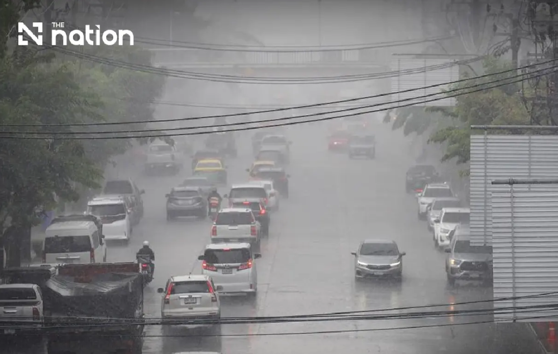
Thailand is gearing up for a potentially severe weather event as the Meteorological Department intensified its alert level on Wednesday, cautioning residents across northern and northeastern regions to prepare for flash flooding that could strike suddenly through Friday. The ninth official warning issued at 5pm on August 19 underscores growing concern about the combination of meteorological factors converging over the country, with forecasters particularly worried about communities situated in vulnerable terrain where water accumulation poses significant danger to life and property.
The atmospheric setup driving this weather crisis stems from two powerful systems working in tandem. A monsoon trough sweeping across the northern provinces has merged with an unusually robust southwest monsoon bearing down from the Andaman Sea, creating a potent recipe for torrential downpours. This dual system is expected to maintain its intensity through the three-day warning period, making it one of the more serious rainfall events forecasted for the region in recent months. The same meteorological conditions are simultaneously whipping up dangerous waves across maritime areas, effectively closing off portions of Thailand's territorial waters to commercial and recreational vessel traffic.
In the North, the Thai Meteorological Department is predicting near-universal thunderstorm coverage, with 80 percent of the region expected to experience electrical storms beginning Wednesday evening and continuing through Thursday afternoon. The most severely affected provinces will be Mae Hong Son, Lampang, Nan, Phrae, Uttaradit, Phitsanulok and Phetchabun, where very heavy rainfall rates are anticipated. Meanwhile, eight additional northern provinces including Chiang Mai, Chiang Rai, Phayao and Lamphun face heavy rain conditions, though somewhat less intense than their neighbours to the east and south. Temperature fluctuations across this zone will remain relatively modest, oscillating between overnight lows of 22 to 27 degrees Celsius and daytime highs between 28 and 34 degrees Celsius.
The Northeast confronts an equally daunting weather pattern, with forecasters projecting identical storm coverage rates to the North. A dozen provinces stretching across the region's breadth will experience heavy precipitation, including important population centres such as Nakhon Ratchasima, Khon Kaen and Ubon Ratchathani. Eight additional northeastern provinces are flagged for very heavy rainfall, particularly Loei, Nong Khai, Bueng Kan and Udon Thani, where the combination of terrain and weather systems could amplify runoff volumes. The risk extends particularly to lower-elevation communities and those located adjacent to natural waterways that swell rapidly when upstream rainfall intensifies.
Thailand's central regions will not escape the adverse conditions entirely. The Central Plain, encompassing agriculturally important provinces such as Nakhon Sawan and Lopburi, faces thunderstorm coverage affecting 60 percent of the territory, with isolated pockets of heavy rain possible. The eastern seaboard proves even more vulnerable, with 70 percent of that region expected to receive thunderstorms and several provinces positioned to receive significant precipitation. Trat, the easternmost province, may experience the most extreme rainfall rates. These eastern and central areas will experience warmer conditions than their northern counterparts, with daytime temperatures ranging between 31 and 36 degrees Celsius in certain zones.
The Bangkok metropolitan area and its surrounding provinces will experience a more moderate weather impact, with thunderstorms affecting 60 percent of the zone and isolated heavy rain possible but not guaranteed. This somewhat less severe outlook for the capital region reflects the positioning of the monsoon trough, which is concentrated further northward. Nevertheless, the capital's vast network of drainage systems will face heightened demand given the broader regional precipitation patterns.
Maritime safety authorities have issued strict guidance for vessels across both the Andaman Sea and the Gulf of Thailand. Waves in the upper sections of both bodies will reach two to three metres on average, climbing above three metres where thunderstorms develop overhead. These conditions are sufficiently hazardous that small vessels in the upper Andaman Sea and upper Gulf have been ordered to remain ashore through Friday, August 21. Larger vessels operating in affected areas are advised to exercise extreme caution and actively avoid thunderstorm cells that pose collision and capsizing risks. The lower Andaman Sea will experience less severe conditions, with baseline wave heights around two metres rising above this level during active storm periods.
Residential preparedness remains critical across affected areas, particularly in foothill settlements and low-lying communities where flash flooding develops most rapidly. The Meteorological Department specifically cautioned residents to monitor accumulated rainfall totals over the three-day period, since ground saturation from earlier precipitation can dramatically lower the threshold required for flooding initiation. Motorists are urged to avoid roads with established flooding histories, particularly those traversing depressions where temporary inundation can occur within minutes of intense rainfall onset. Planning travel carefully and monitoring evolving official forecasts represents essential precautionary behaviour.
The convergence of these weather patterns carries implications beyond the immediate rainfall and flooding threat. For Malaysia and other Southeast Asian neighbours, Thailand's experience with this monsoon system provides a preview of conditions that could track southward over subsequent days. The intensity and persistence of the southwest monsoon component suggests that regional moisture transport could intensify across a broader geographic area than initially anticipated. Agricultural activities across northern Thailand, particularly in provinces dependent on seasonal cropping cycles, may face disruption if flooding damages standing crops or delays field preparations. The tourism sector likewise faces potential complications if major destinations in the north experience significant weather-related infrastructure damage or accessibility problems during this period.

