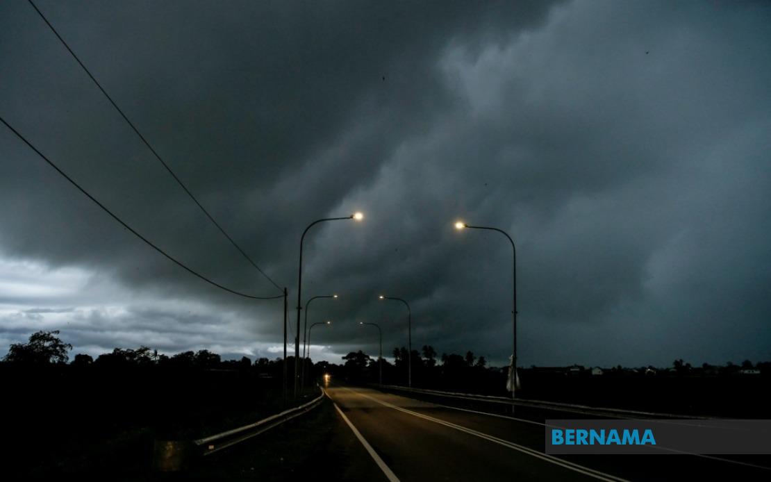
Residents across seven Malaysian states face hazardous weather conditions through midnight following an alert issued by the Malaysian Meteorological Department. MetMalaysia has flagged a developing system bringing thunderstorms, heavy downpours, and powerful gusts that will sweep across multiple regions of Peninsular Malaysia, Sarawak, and Sabah. The department's warning underscores the intensity of weather patterns currently affecting the nation, with conditions expected to persist through the evening hours.
The entire state of Melaka stands in the path of this severe weather system, making it one of the most vulnerable zones. Additionally, the eastern coast of Peninsular Malaysia faces particular risk, with MetMalaysia identifying Setiu, Kuala Nerus, Hulu Terengganu, Kuala Terengganu, Marang, Dungun, and Kemaman in Terengganu as areas of concern. This cluster of districts along the South China Sea coastline frequently experiences amplified storm activity during monsoon transitions, and residents in these communities are urged to exercise heightened caution.
Inland regions across multiple states have also been flagged by meteorologists. In Pahang, the Jerantut and Bera districts lie in the affected zone, areas that have experienced significant flooding episodes in previous weather events. Negeri Sembilan's Jempol and Tampin districts round out the central peninsular coverage. The southern reaches of the peninsula will not be spared, with Johor experiencing the broadest geographic impact—including Tangkak, Segamat, Muar, Batu Pahat, Kluang, and Pontian all expected to encounter the adverse conditions. This extensive coverage of Johor reflects the system's tendency to influence weather patterns across the entire southern region.
On the island of Borneo, Sarawak's eastern districts face heightened risk. Sarikei and Sibu, both significant urban centres, are positioned within the warning zone, alongside the more remote areas of Limbang and Song in Kapit Division. The Betong Division, which encompasses Pusa, Saratok, and Kabong, also appears vulnerable to the incoming weather system. These areas, while accustomed to tropical rainfall, may experience particularly intense precipitation during thunderstorm events, potentially disrupting river transportation and agricultural activities that remain crucial to local economies.
Sabah's interior and eastern regions are similarly threatened. The Sipitang district in the Interior Division joins a broader alert area that encompasses the more densely populated zones of Sandakan and the Tawau Division districts of Tawau, Kunak, and Lahad Datu. The convergence of these warnings across both Malaysian states on Borneo indicates a system of considerable geographical reach and meteorological significance. For residents and authorities in these regions, the alert period through midnight necessitates active weather monitoring and preparedness measures.
Thunderstorm warnings of this scope carry substantial implications for public safety and essential services. Strong winds accompanying such systems can damage infrastructure, particularly in rural areas with older building stock or exposed facilities. Heavy rainfall, especially when concentrated in a short period, raises flash flooding risks in low-lying districts and areas with poor drainage. Communities in river basins, particularly in Pahang, Terengganu, and Sarawak, should remain vigilant about water level rises that could affect riverside settlements and transportation routes.
The timing of this warning—extending through midnight—suggests the system is expected to move through its most intense phase during evening and early night hours. This temporal pattern typically aligns with diurnal heating effects that strengthen convective activity, though the specific trigger for this event likely involves regional wind patterns and moisture availability. Residents should secure outdoor items, avoid unnecessary travel during peak storm hours, and remain alert to local emergency communications. Drivers should exercise particular caution on highways and secondary roads where visibility may become severely compromised and road conditions deteriorate rapidly.
For aviation and maritime operations, the warning carries operational significance. Thunderstorms of this intensity can disrupt flight operations and create hazardous conditions for vessels, particularly smaller craft and fishing boats. Port authorities and maritime agencies typically implement precautionary measures when such alerts are issued, potentially affecting commercial shipping schedules and fisher livelihoods during the warning period. The breadth of the alert area suggests coordination across multiple regional meteorological monitoring stations and indicates high confidence in the forecast parameters.
Authorities in affected states may activate contingency protocols for emergency response personnel, ensuring rapid deployment capability should incidents occur. Local governments often pre-position resources and alert relevant agencies—including fire departments, civil defence units, and public works teams—when comprehensive weather warnings of this nature are released. Schools and public institutions in the identified zones should have weather protocols in place, though given the midnight deadline, most day-time operations will have concluded before peak storm activity.
The geographic spread of this warning across the peninsula and both Malaysian states on Borneo reflects the scale of the meteorological system at play. Rather than a localized phenomenon, the pattern indicates a broad-scale weather disturbance influencing conditions across the entire nation. This type of extensive warning, while sometimes routine during seasonal transition periods, requires sustained public awareness and responsible communication by authorities to ensure residents take appropriate precautions without unnecessary panic.

